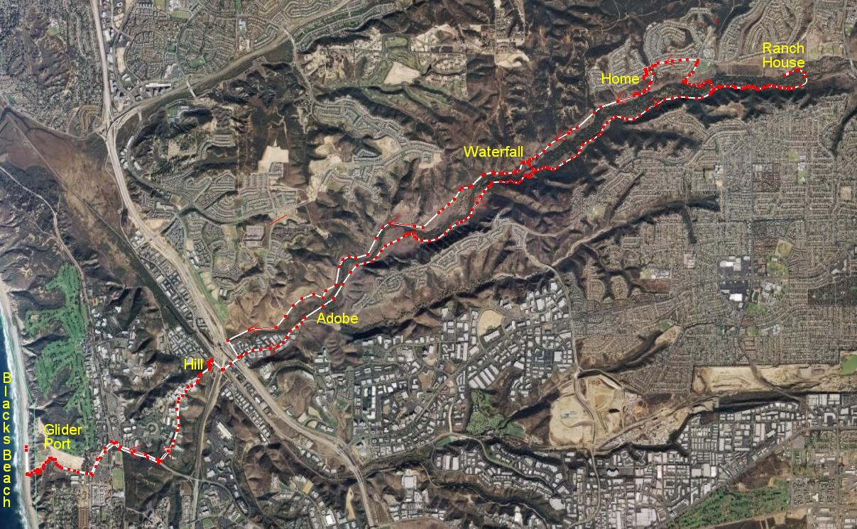
After hiking up Pikes Peak a few weeks ago, I had only two other exercise goals this summer: to hike from my home to the nearest beach, and to walk a significant fraction of a marathon distance. While I am still in good shape, I planned on the beach hike on a weekend when the weather was not too hot (80 F was the noon-time temperature). I started just before 8am, with the goal of walking 2.5 hours, resting on the beach for an hour, then another 2.5 hours back home. This would have been a 17 mile hike, but when I reached the turnoff to go back home, I felt good enough to add another four miles. This would be my longest hike ever, and attain my goal of hiking 80% of a marathon. Since I was carrying a small daypack up and down some hills on a trail, I figured that this might be pretty close to a full marathon, and give me confidence in walking the San Diego Rock and Roll Marathon next June.
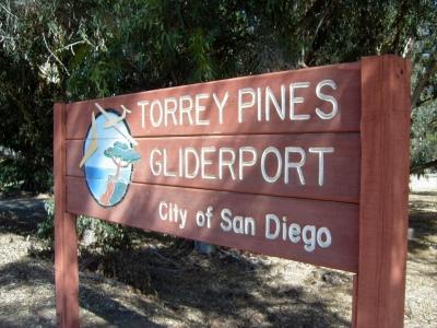
The hike started at my house, and much of the route goes through the Los Penasquitos Canyon Preserve. Its a pretty straight shot to the Torrey Pines biotech campus area, just north of UCSD, into the gliderport, then down the cliffs to the beach. I've taken parts of the hike this summer, to check out access and timing, but never put them all together. This was my last realistic chance this summer. Based on my upcoming business travel, I'd probably not be in as good shape again until the end of November, when the rains will close the Preserve for the winter.
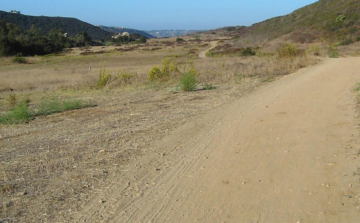
After June, the landscape through the Preserve is pretty brown and dusty. Lots of hikers, horseriders, and bicyclists use the wide trails that sometimes get narrow and rocky. This view is about a mile into the hike. The clump of rocks in the upper left marks the waterfall area, a popular stopping and turn-around place for hikers starting from the parking lots on either end of the Preserve. Homes border the canyon (including mine), but most are fairly well hidden from the canyon bottom, giving a pleasant hike. Surprisingly, the trails are usually pretty empty, considering its prime location in northern San Diego. The intermediate goal of this hike is seen in the buildings at the farthest end of the canyon, the Torrey Pines biotech campus.
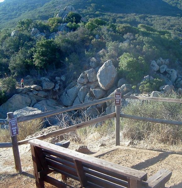
The only park bench in the entire Preserve is this one overlooking the waterfall, on the less-popular northern route. It makes a nice turn-around point when I hike with others, giving a nice one-hour hike.
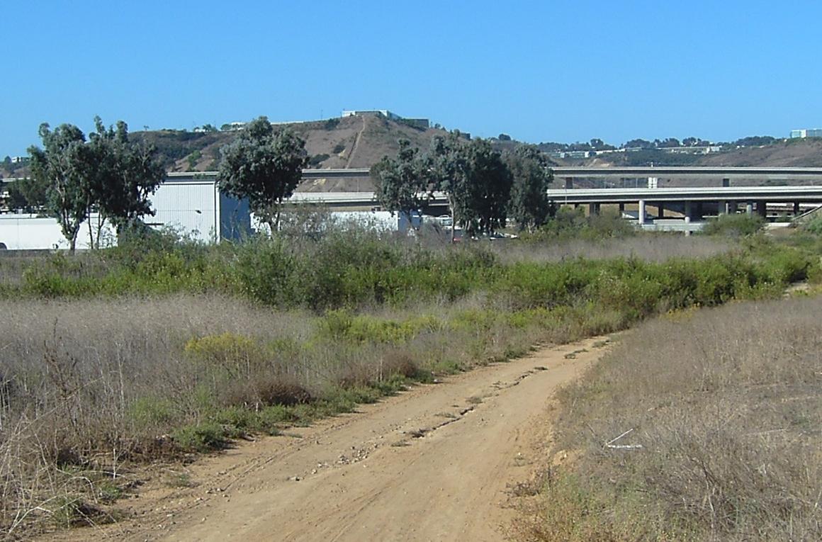
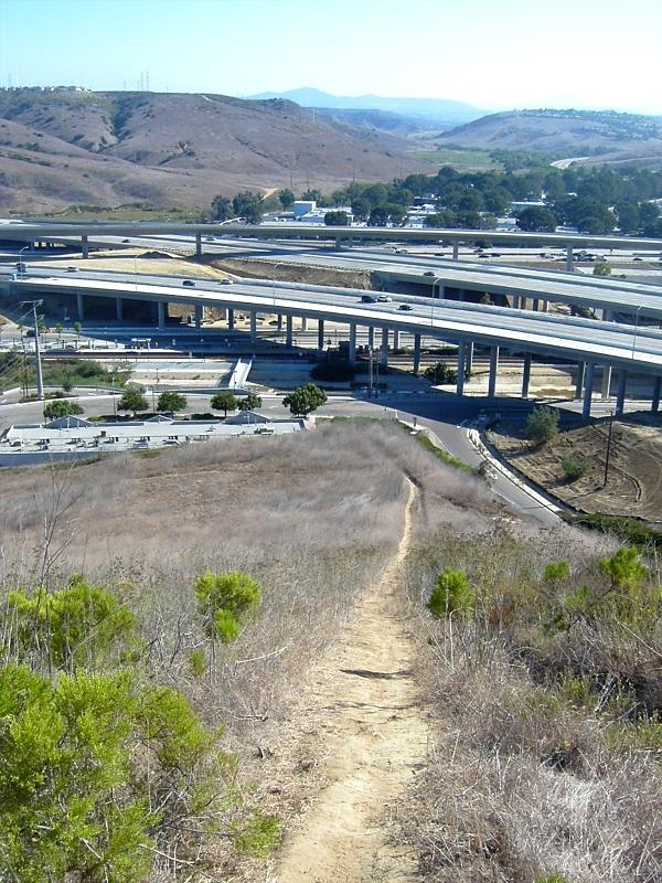
At the end of the Preserve, where the Canyon drains into a saltwater lagoon, a business park is located next to the I-5 and I-805 merge. The steep trail up to Torrey Pines is the only route I could find that goes from this area. All other routes are automobile only; too many canyons in this part of San Diego, and not enough sidewalks. After going under the freeways, the route up the hill leads to the biotech campus area.
The view from near the top of the steep hill looks back into the Preserve, toward Rancho Penasquitos and Poway. This point was 1hr 45 minutes and 5.8 miles from home. A deli at the bottom provided a convenient stopping place on the way back to buy a cold soda and a snack.
Less than a mile from the beach! Total distance 7.6 miles, not quite 2.5 hours from home.
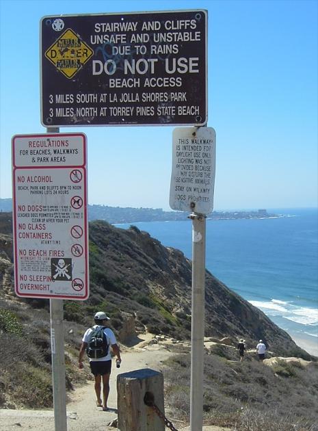
At the top of the trail down to the cliffs, the signs appear contradictory. While the trail is officially closed for legal reasons, other signs indicate that it is "use at your own risk", giving standard beach use regulations. From the obvious foot traffic, the top sign is pretty well ignored.
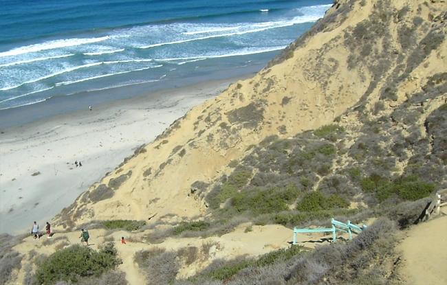
The trail down the cliffs is winding and not well-maintained. Lots of steps are 24" high, cut into sandy rocks, with remnants of some wooden beams. A rope near the bottom is useful to maintain footing on a particularly steep, one-way traffic section. The top of the trail is about 300' above the beach. Its still about 10:30 in the morning, but the ocean fog has already cleared off to a nice, sunny day - and I didn't apply any sunscreen before I left home. I was planning on a little cooler weather, but since it is so early, the UV rays shouldn't be too much of a problem. My feet and legs are doing pretty good, so I had no problem with the steep trail.
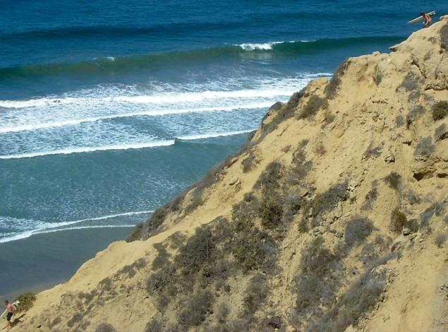
Some surfers apparently prefer a more direct route down to the beach. They are either avoiding the warning signs on top of the main trail, or want to get down even quicker. When the evening news occasionally reports hikers stuck or injured above this beach, I suspect these alternate trails are where the falls occur.

After 8.7 miles in slightly under three hours, I made it from my home to the Pacific Ocean! I could not get the self-timer on the camera to work, so I hand held this shot - hence my slightly puzzled look. the white spots on my face are sunlight from holes in the hat - not beads of sweat. I actually felt pretty good. Note how clean the beach is, and how nice and flat. Its a great beach for wading, and this helped cool and relax my feet.
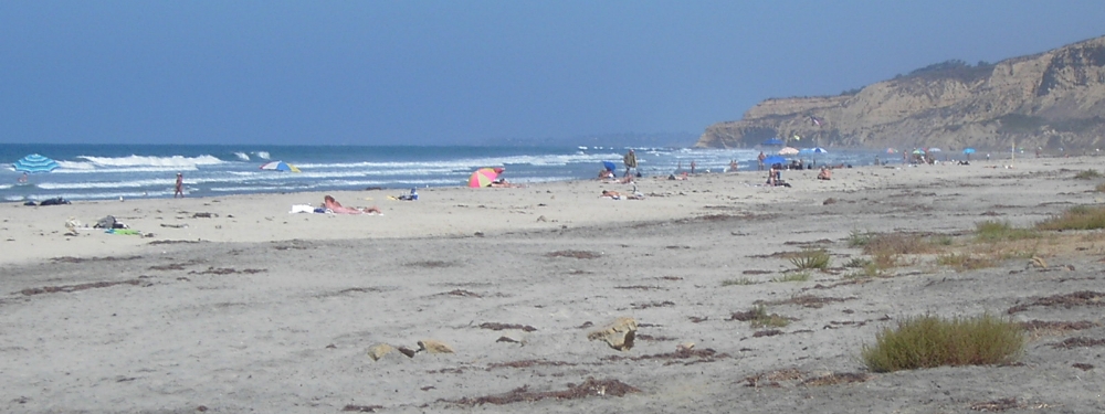
After about 45 minutes of rest, I started my return up the cliff and back home. Its now about 11:30, and the beach is starting to get a little more crowded. I don't understand how people can carry these large umbrellas down the trail, but they probably did not start from 8 miles away!
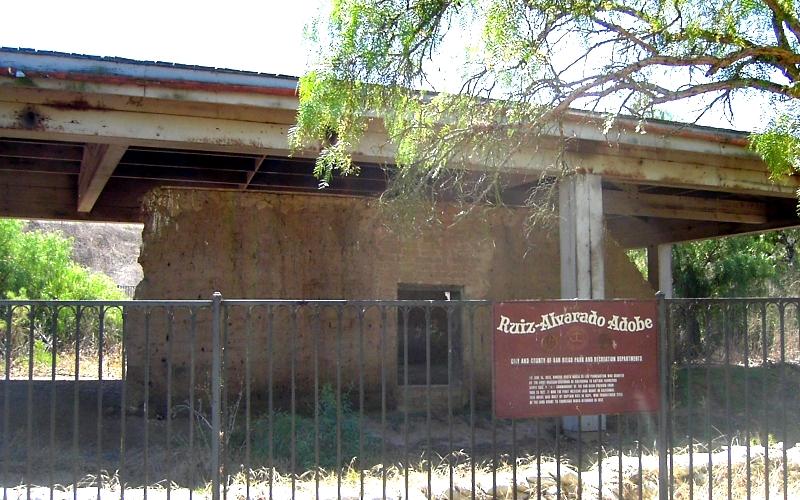
One of the more historic sites in San Diego is the original adobe house built in 1824. It is practically deserted, and practically unknown to tourists, but maybe that is because there is not much left of it under this protective cover.
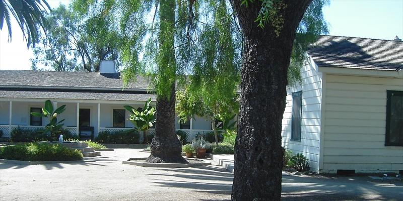
After hiking 16.5 miles over six hours, I decided to bypass the turnoff that led directly home, and continue eastward for a few more miles. I still had a bottle of water, and my snack at the bottom of the hill was enough to keep me going. Near the eastern edge of the Preserve is another historic structure, the original Penasquitos Ranch house. Rangers and docents regularly give tours of this small complex of building, but I was only interested in resting my feet. While my legs we doing fine, the bottoms of my feet were starting to develop painful calluses. This is the turnaround point, at 18.6 miles.
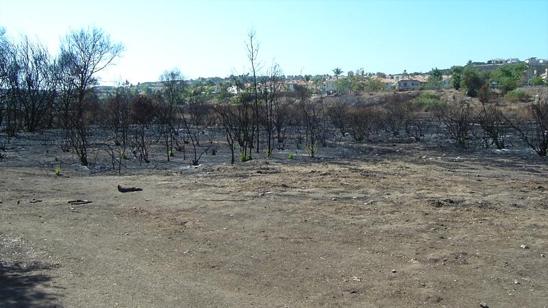
On the way back to my house (hidden in the trees on the left side), is a small burned area. Back in July, some kids were playing with fireworks and set off a brush fire that spread over a few acres, dangerously close to many homes. Luckily, it was early in the fire season, so a full complement of firefighters were available to stop the spread without much damage. It was stopped about a half mile from my home.
After 21.0 miles, I returned home 7.5 hours later, only slightly sunburned, but with sore feet. I don't think I need to repeat this hike, but it was a good feeling to know that I can probably finish a 26 mile marathon next year. It was also good to know that I can probably tackle Longs Peak in a single day (14 miles round trip), maybe as early as next year!
Links to other Stellar Products pages: