
Just a few days after our Pacific coast cruise, Carol celebrated her birthday, then I headed up to Three Rivers to start a few days of hiking. The weather was nice and warm, so I was hoping there were some other hikers on the trails, in case of emergency. Fortunately, there were a few isolated hikers, and I did not have any problems. Carol and I hiked part of the way up Sawtooth Pass about 30 years ago, so I was curious to see if I could make the entire hike up to Sawtooth Pass or even the summit. Although I am older, I think I have similar endurance, perhaps aided by motivation matured by age. And I would not be slowed down by Carol!
The views of the higher nearby peaks made the hikes more enjoyable. The ground covers were still pretty green in late September. The start of the trail was pretty steep and difficult, but I really did not remember it, nor did I remember how far we made it last time. I decided to save Sawtooth for later, and get warmed up and acclimated by hiking first to Crystal Lake, about a 10 mile round trip with 3000' elevation gain, ending at 10,800'

Hiking near timberline is always my favorite. Still nice and warm. I caught up and hiked about one mile with a guy named John from the the Bay area. He took the trail divide to try Sawtooth, but I don't know how well he did. I am pretty sure I haven't been here before. I met one older guy coming down the trail.
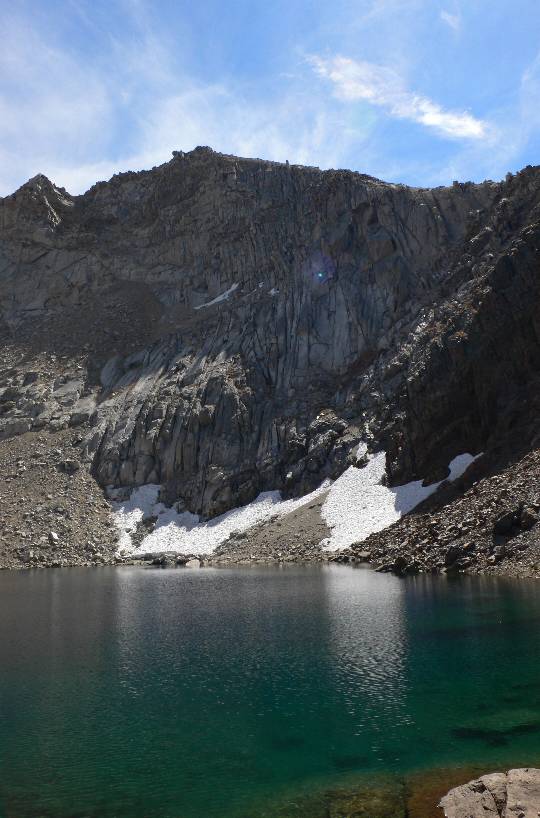
Crystal Lake still had a little snow around it, certain to last year-round.
Looking back to the mountains just above Crystal Lake, with the stream coming from the lake.
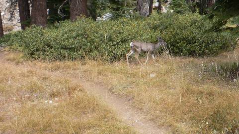
Lots of deer were near the trail.
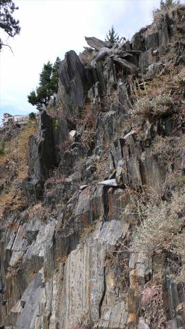
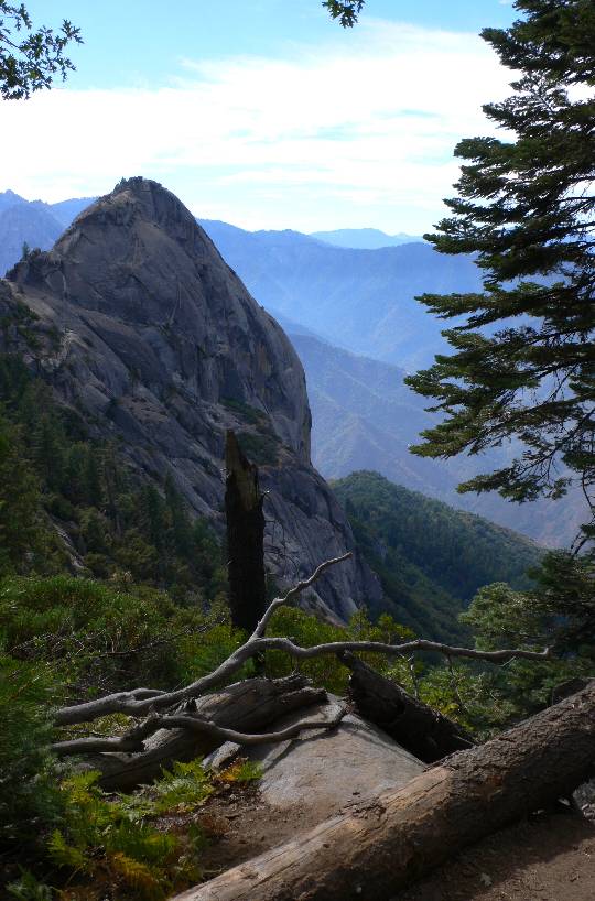
This is the same rock formation I have a picture of from 1980. It was in October back then, and was covered in a brilliant orange. Proof I made it this far, but its really not far from the trailhead. This was a nice 10 mile hike, done by about 2:30 p.m.
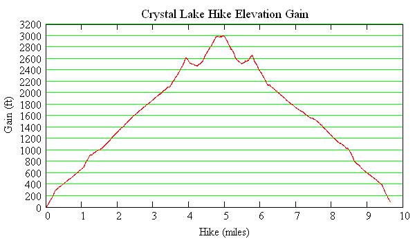
The elevation profile from the hike, downloaded from my GPS/barometric recorder, shows an initial 21% slope at the trailhead (it seems the beginnings of all trails are steep, to weed out the casual hikers!), followed by a smooth slope of 11% for the next 3 miles. Near the lake, the slope went up to about 21% a couple times.

Carol and I also went to Moro Rock, a very short hike, but all steps! Sawtooth Peak is the summit in the third range just left of center. The hikes today were meant to rest my legs and get more acclimated.
Moro Rock is one of many granite outcrops in the park. This view is from Hanging Rock.

I always try to take cave tours. Crystal Cave is inside the park boundary. The rooms were above average, but the tour guide got a lot of stuff wrong. I'm sure he was reading from a memorized script, so its surprising it has not been reviewed. I noted other signs in the park were outdated, but I'm sure they will stay that way for a long time. (Examples, converting climate zone altitude ranges in feet to precise meters, a sign noting something that happened in the '80s (1880's or 1980's?).)

Another view of Sawtooth Peak from the road to Mineral King.
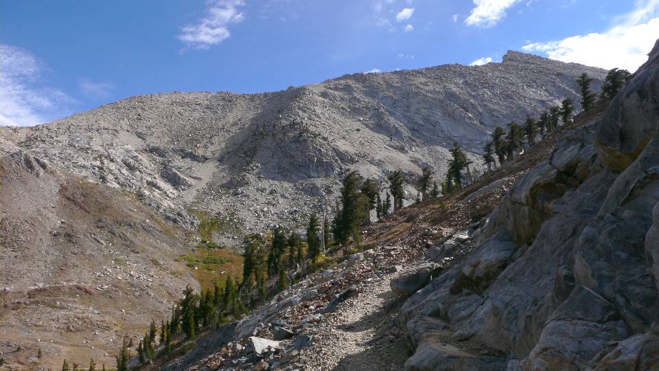
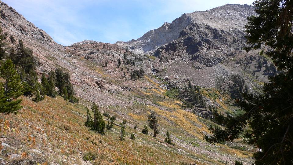
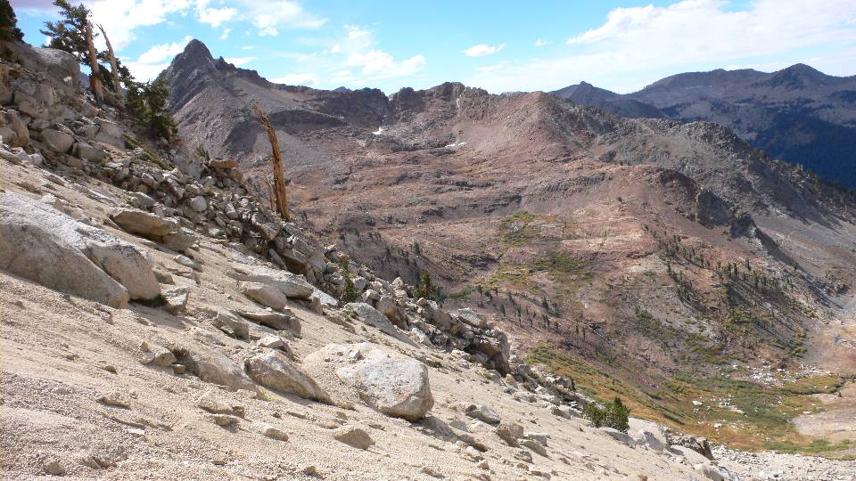
I stayed overnight at a cabin in Silver City, just a few miles from the Sawtooth trailhead, so I could start earlier in the morning. After the trail split from Crystal Lake, the Monarch Lake trail turned the corner for the first view of Sawtooth up close. The trail ends up to the steep valley just to the left of center and then to the left to Sawtooth Pass. The approach to the summit is along the ridge.

No snow at Monarch Lake, still nice and warm.
The trail up the valley is nothing but coarse sand. One step forward and then slide one-half step sliding backward over this pretty steep section. Click on the photo for a movie.
This is about as far up that I could go before I lost the trail. From the map, the trail veered to the left, but it was so steep and progress was so slow, that I also ran out of time. I was an hour away from my planned turn-around time, but threatening clouds were starting to appear. Monarch Lake is just above the steep valley, hidden by the nearby rocks. The stream fed by the lake is seen going down the valley, just like Crystal Lake. The trail is also seen just above timberline on the right.

I was concerned about going safely down the sandy trail without falling, but it was actually pretty easy, and fast! Just before I turned around, I was practically on hands and knees getting up the slope (where I also lost my glasses), so I know the slope was pretty steep.

I passed two guys hiking up the same path, and warned them that I lost the trail just about where the sandy region stopped, marked with the blue circle. The two figures near the bottom give a good scale. The switchbacks in the sand are just visible.
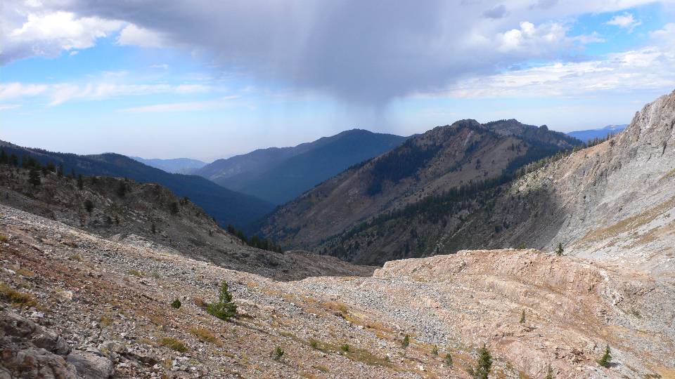
Still near Monarch Lake, the rain and dark clouds in the valley below were getting larger, and thunder could be heard. I went down hill as quickly as I could, so I could get below timberline before any nearby lightning. I only got a few sprinkles on the trail, but the road down to Three Rivers was pretty wet in places. Since it was still nice and warm, the amount of rain must have been about 1/4".
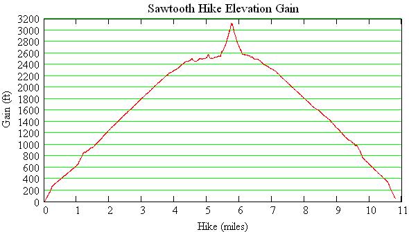
My GPS recorder data showed a 21% slope at the trailhead, with a remarkably even, average slope of 10% for much of the hike up to Monarch Lake. The last part of the trail, up a sandy slide, had a slope of 35%, and that includes the switchbacks! Straight up the slide would have been close to a 45 degree slope. I don't feel so bad now! The total hike time was just over 6 hours.
All text and images are owned by Stellar Products, 1992-2010. Any use by others without permission of Stellar Products is prohibited.
Links to other Stellar Products pages: